
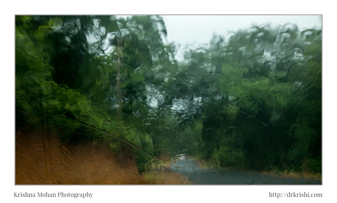
Shiradi Ghat is a 35kms stretch of ghat section on the NH-75 highway through the Western Ghats connecting Mangalore and Bangalore, the state capital of Karnataka. This section of the highway has refreshing scenic views to offer during monsoon. I drove through this stretch just a couple of days ago, on my way towards Bangalore from my home town Moodubidire. The Shiradi waterfall I posted in my earlier blog was taken on this road.
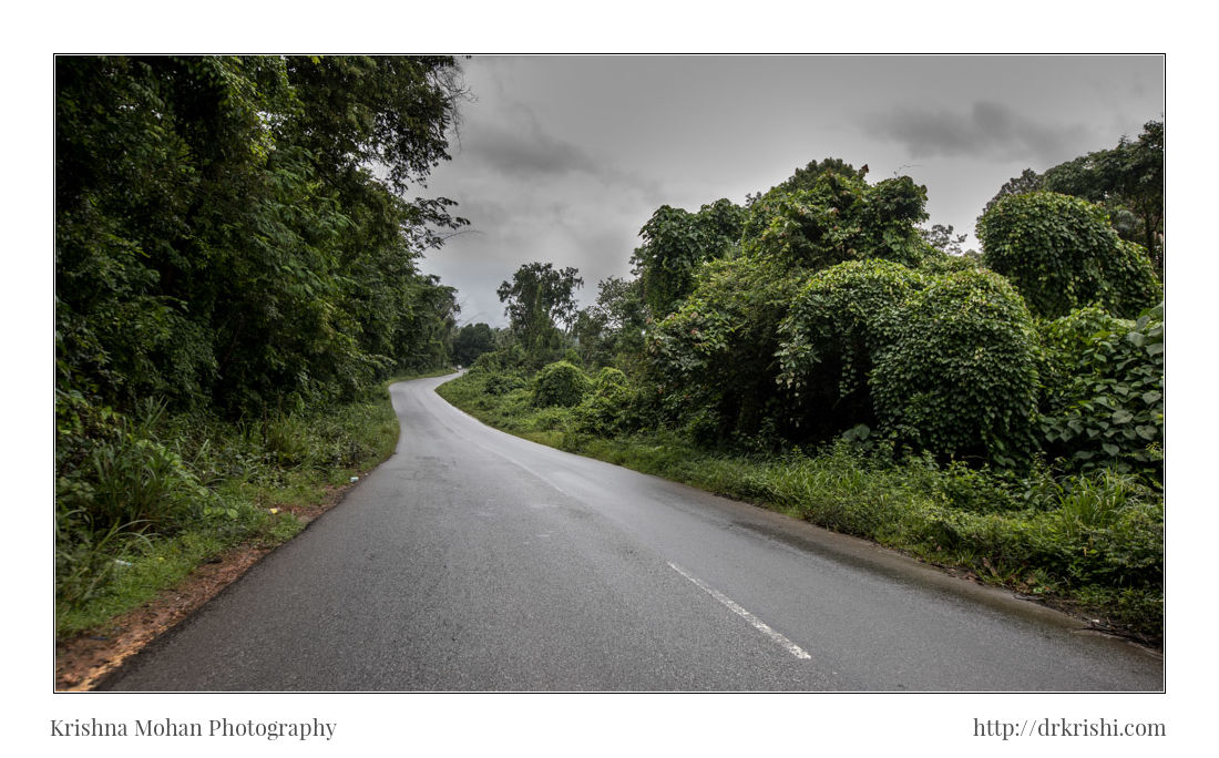
It is called Shiradi Ghat (Not to be confused with the famous “Shirdi”, in Maharashtra), after a village called Shiradi at the border of Dakshina Kannada and Hassan districts of Karnataka. Year after year, crores of rupees are spent for a thin coat of tar that wears off very easily with the force of nature. Also, thanks to the heavy vehicles like tankers that erode the road, further damaging the highway. Quite a long stretch of this highway is now laid in concrete, so travel along the concrete portions is very good. Some more portions which are still laid in tar and gravel, are filled with potholes. Shiradi is the nearest, widest road to Mangalore from Bangalore so a lot of traffic hits this highway.
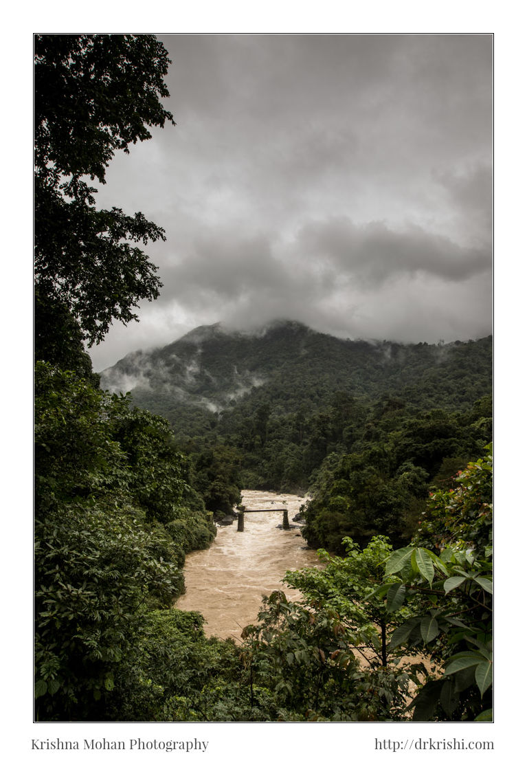
Here you can also see a broken man bridge and the gushing Kempu Hole river. Behind this beauty lies a dark truth. The beauty what you see, may not last for next generation.
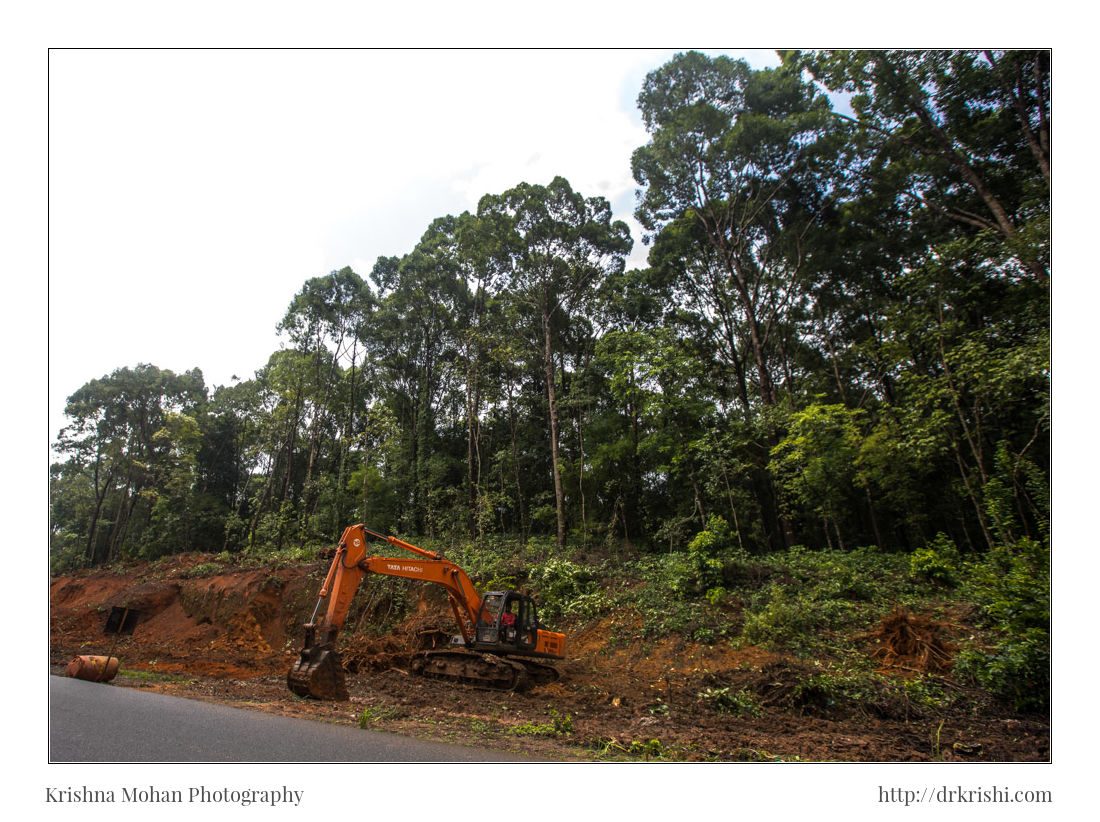
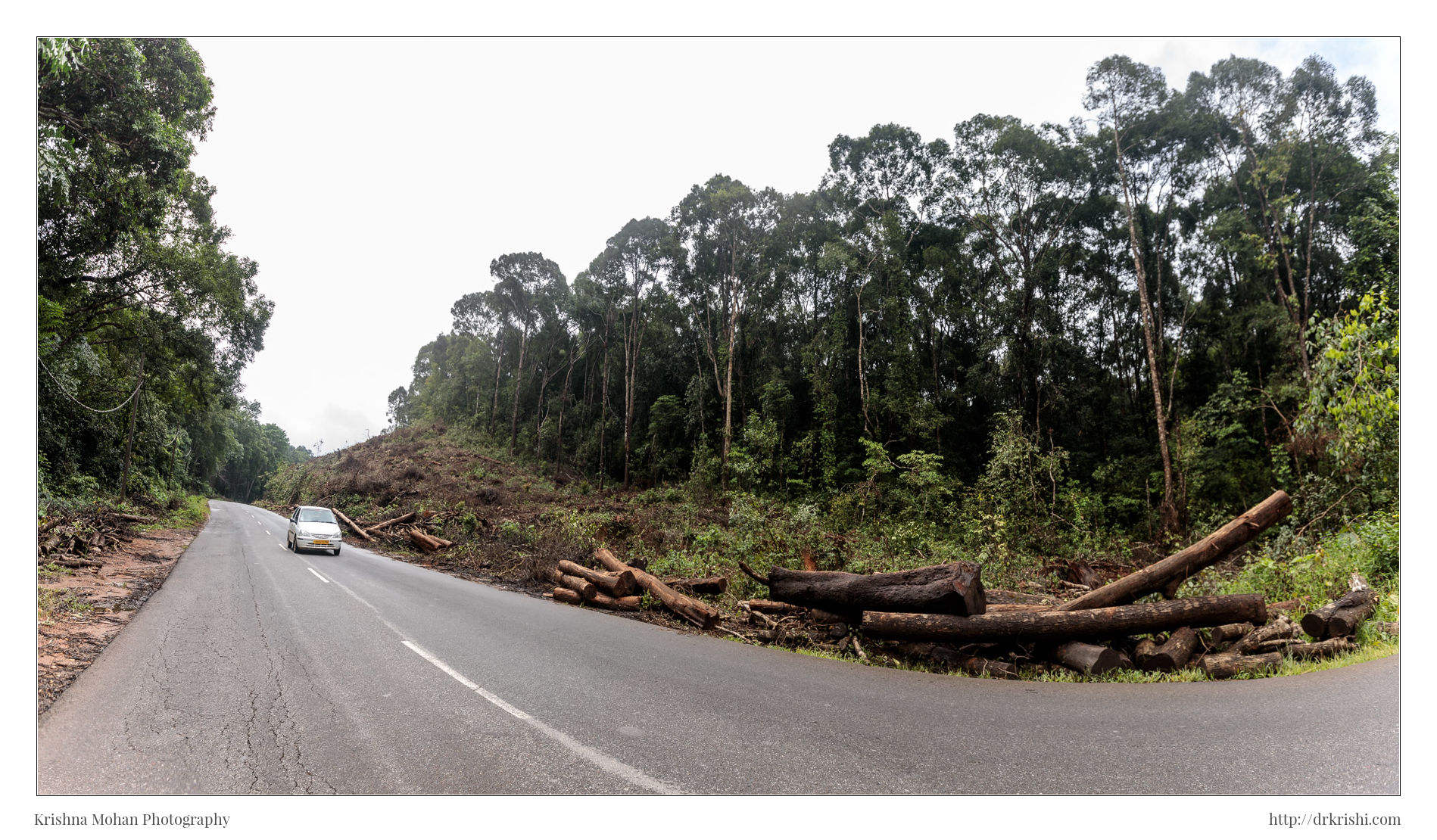
The work on concreting and widening National Highway 75 to four lanes from BC Road to Addahole in Shiradi village has just begun. All the photos here are taken using Canon EOS-5D Mark IV and Canon EF 16-35mm f/2.8L II USM Lens
The 63-km-long concrete road passes through Shiradi, Shiribagilu, Noojibalthila, Ichampady, Nelyadi, Konalu, Golithottu, Bajathooru, Uppinangady, Nekkilady in Puttur, Rekhya in Belthangady, Biliyooru, Perne, Kedila, Mani, Balthila, Golthamajalu, Panemangalore Kasaba, Narikombu and Mooda. The stretch also passes through one of the dense forest ranges of Uppinangady, Panja, Puttur and Bantwal.
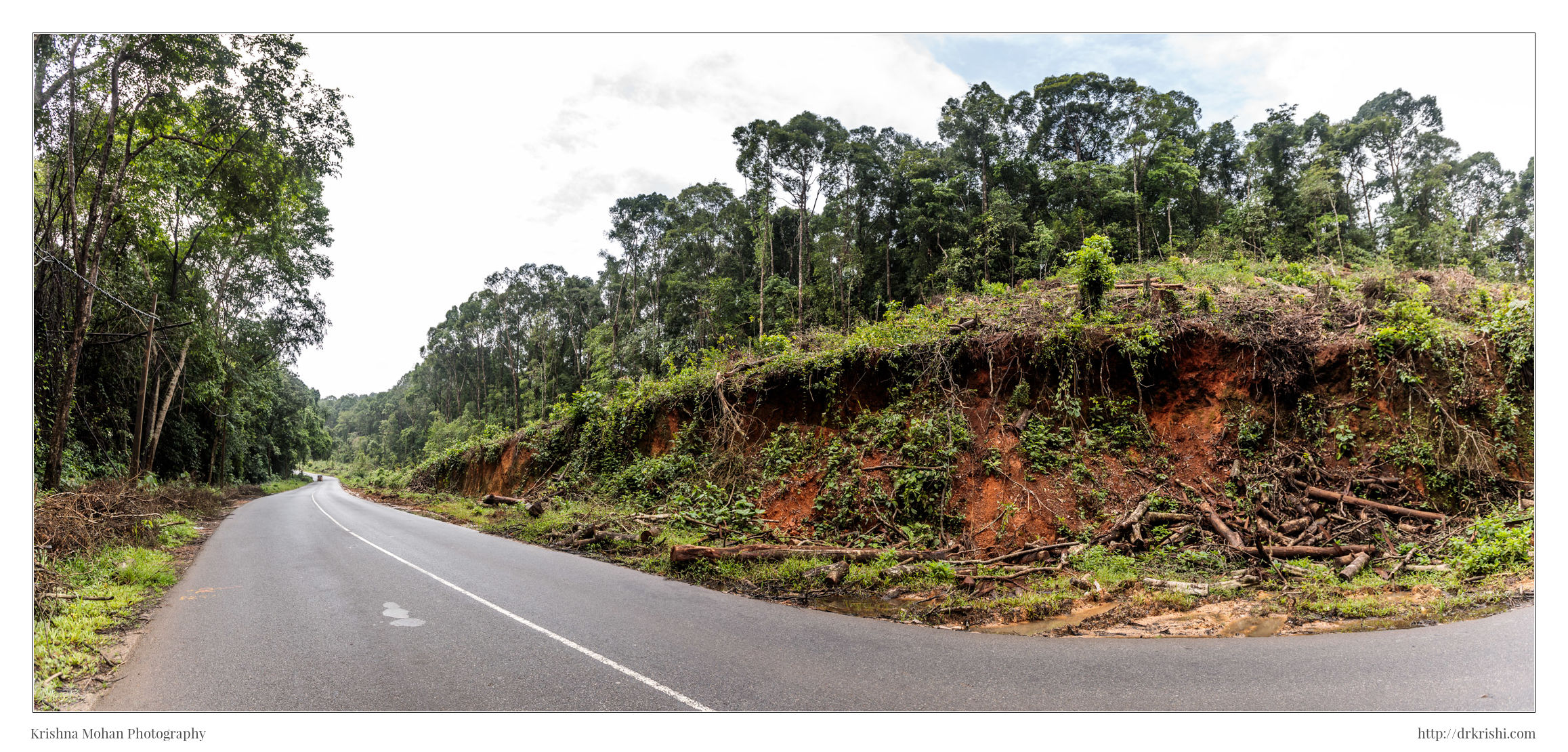
This Road widening is going to destroy about 10,196 large trees. About 70% of the trees have already been removed. The work on clearing boulders at Bedrodi in Addahole has also started. The road is being widened wherever trees have been removed.
Shiradi Ghat has already suffered enough damage due to the Bengaluru-Mangaluru Highway and the railway line. Now that the government has proposed the tunnel project, it is bound to cause further destruction.
Assault on the Kempu Hole region is happening incessantly in the name of development. First was oil pipe line from Mangalore to Bangalore, then High voltage Electric wires cutting through the ghats. Then came the Gundya Hydel project and recently it is the Yettinahole project for which work has been taken up at full speed. Kempu Hole originates from the Shiradi Ghat region of Western Ghats and is an important tributary of Netravati along with Elaneer, Aniyur, Kumaradhara, Mrithunjaya along with Bandaje, Sunala, Neriya and Kapila.
People of Sakleshpur in Hassan district depend on Kempu Hole for drinking and irrigation purposes, but several dams are being built in this region. Two dams each at Yettinahole, Hongadahalla, Kadumane and one at Kerihole are being built, resulting in the destruction of eco-sensitive areas. Destroying one tributary completely is bound to affect the water flow of all the tributaries and in turn Netravathi, the lifeline of the people of Dakshina Kannada.
Beautiful photogrpahs
very good photographs.
I want to enquire on road condition from Gundya to Sakleshpur.
How is it ? How much time will it take ?