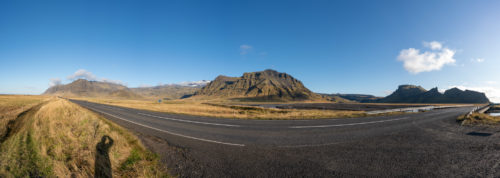
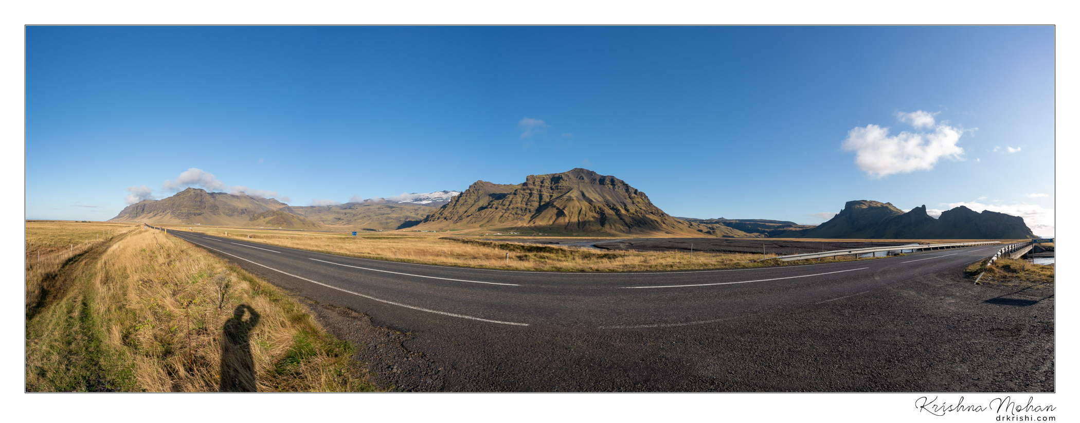
For our third day in Iceland, we wanted to explore southern Iceland. So, after our breakfast, we started on the Ring road or Road#1 towards east. When driving on the main road #1 or ring road direction east you take a turn to the right to road 218 to reach Dyrhólaey which was our first stop of the day. Here is a panorama of the Skeiðflötur area which is the junction where Route 218 on ring road.
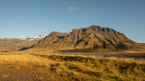
As you drive that road 218 to an end but you get two options i.e. either drive it all the way or make a right turn up the hill which is what we took. That is because Dyrhólaey is divided into two parts i.e. the higher and lower part. We took the Higher part which leads us to the Dyrhólaey Lighthouse.
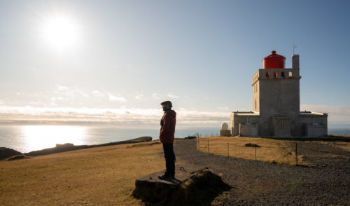
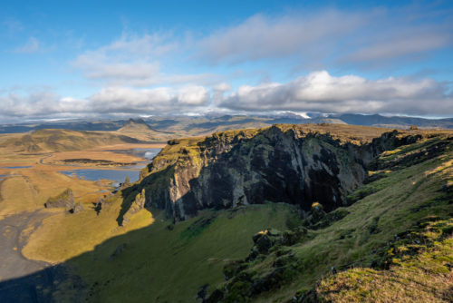
Dyrhólaey in direct translation is ‘doorway Island’ or Portland and despite being called an Island it is more a cape than an island as it is connected to the mainland. The Island is divided into two parts. To the west is Háey (High Island) and to the east is Lágey(Low Island) The peninsula has an elevation of 120 meters and the Dyrhólaey Lighthouse sits at the top of the formation facing the sea.
Dyrhólaey was probably formed sometime before the last glaciation and might have been at its maximum level about 25.000 years ago when the sea level was similar to now but after its formation, glaciers most likely grew over it and eroded the Island.
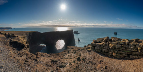
Since the melting of the glacier, the ocean has been pounding on the island and shaped it as well as the famous arch-way, Tóin and will keep on doing so as it is estimated that the area of Dyrhólaey is only quarter of its origin today. In May 2012, a large part of the island broke off.
An estimated area of four to five meters wide and 100 meters long fell down the cliffs that at that point are 20 – 30 m high. For some strange unexplainable reason two travellers that were standing on the edge, fell down with it and escaped with relatively minor injuries. In 2015 there where again two more large rock falls from the cliffs of Dyrhólaey.
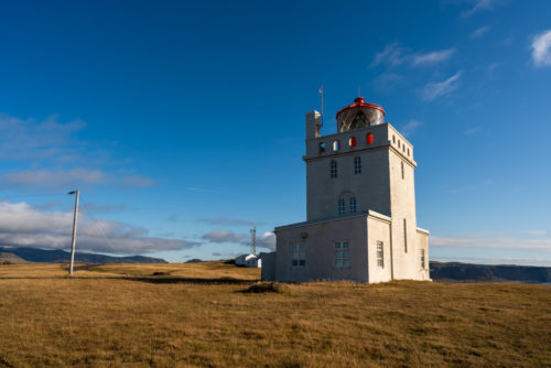
On top of Dyrhólaey stands Dyrhólaeyjarviti, a beautiful old lighthouse that consists of a white, square concrete tower. The original design was by former state architect Guðjón Samúelsson but later changes made by engineers Benedikt Jónasson and Thorvald Krabbe. The first lighthouse in the area was built in 1910 and was the first steel-based lighthouse in Iceland. The current construction was completed in 1927. It is a Lighthouse built of concrete with very strong gas lights that threw its beams far out on to the ocean.
The lens in use is a 1000mm rotating lens and the most powerful such in Iceland. The gas lights wherein the lighthouse from 1927 until 1964 when electricity took over. It has the strongest lights of any lighthouse in Iceland. As well as the lighthouse there was a radio station on the second and third floor until well over the end of the second world war. This was the first radio-lighthouse in Iceland. Visitors here will be able to see the lighthouse flicking out beams of white light to sea every ten seconds at night.
The lighthouse houses today a guest suite with three rooms of luxury type. There is no restaurant at the lighthouse but if you stay a night there you can arrange for a private chef from Vík, obviously at a great cost ?
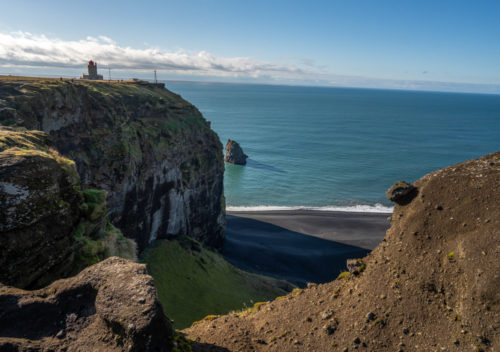
During spring/summer time or nesting season, Dyrhólaey has limited access. It could be closed somewhere between 1st and 12 of May and then limited access until the middle of June. During the nesting season, the lower part is open to car traffic but the higher part is then only open to travellers on foot during the daytime. 8th of May till 25th of June between 9 am and 7 pm. During the restriction hours, it is not allowed to be out of the paths and the roads. The nature reserve is closed during the night from 7 pm to 9 am. From the 25th of June, the area will be open 24 hours.
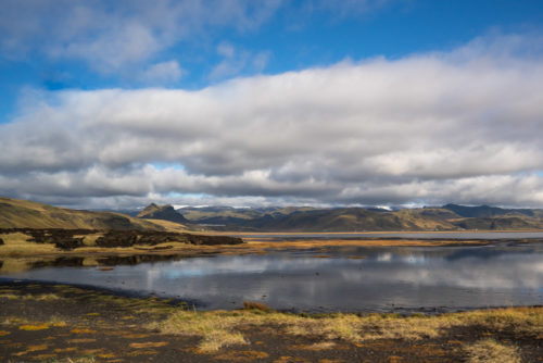
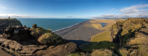
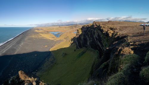
Once you are on top in the higher area of Dyrhólaey you will have a breathtaking view to all directions. To the north you see Mýrdalsjökull glacier, to the east you will see the beautiful black lava sea stacks, Reynisdrangar and to the west, you can view the endless black coastline and then in front of the peninsula there is a huge black arch of lava reaching out into the sea which the peninsula takes its name from. Dyrhólaey literally means “the hill island with the door hole”.
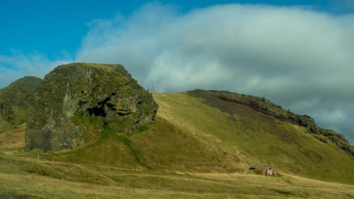
On the southern edge of Iceland, minutes away from the black sand beaches of the Dyrhólaós peninsula is a lonely cave called Loftsalahellir. In the early days Loftsalahellir Cave at the foot of the Geitafjall mountain/or rather hill used to be an assembly place. Nowadays, it becomes a really popular selfie location. We didn’t hike to it, this photo was taken from the car as we were travelling.
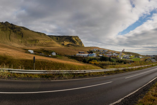
Our next stop was Vik. The village of Vík (Vík í Mýrdal in full) is the southernmost village in Iceland, located on the main ring road around the island.
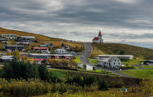
Despite its small size (300 inhabitants), it is the largest settlement for some 70 km around. It is an important service centre for the inhabitants of and visitors to the coastal strip between Skógar and the west edge of the Mýrdalssandur glacial outwash plain.
Víkurkirkja, the famous church is the most iconic landmark in Vik! Or at least the most photographed! The famous red-roofed church was finished in 1934 for the small population of pre-tourism, 1930’s Vik. This church is especially popular for weddings and given the villages close proximity to Katla volcano if it was to erupt or something bad to happen, the church is the evacuation spot and is believed to be the only location in the village out of glacial meltwater, due to its high position.
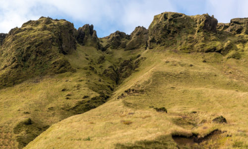
We had our lunch at the nearby service station and headed towards Hjörleifshöfði. Hjörleifshöfði or the cape of Hjörleifur is an enormous rock, 221 meters located at the South West corner of Mýrdalssandur Black Sand Beach. It formed in a volcanic eruption underneath a glacier during an ice age.
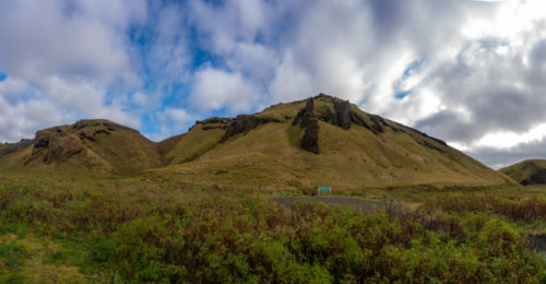
The cape is named after the Viking settler Hjörleifur Hróðmarsson, Ingólfur Arnarsson foster-brother. They sailed together from Norway to Iceland on separate ships but got somehow got separated and ended up staying the winter in different capes. Hjörleifur’s slaves killed Hjörleifur and fled with his women and things to the Westman Islands, which take their name from these Irish slaves. Ingólfur his brother, heard what had happened, sailed to Westman Islands and killed the Irish slaves, therefore avenging his brother “an eye for an eye”.
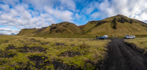
At the top of the Hjörleifshöfði cave is a landmark named Hjörleifshaugur and that is where Hjörleifur is believed to have been buried.
There are fantastic and historical trails to be walked all around the cape which we found out was around 7Km long. Since we had run short of time as we wanted to cover the glacier, we decided to skip the hike and resumed our trip to the next destination on the Ring Road.
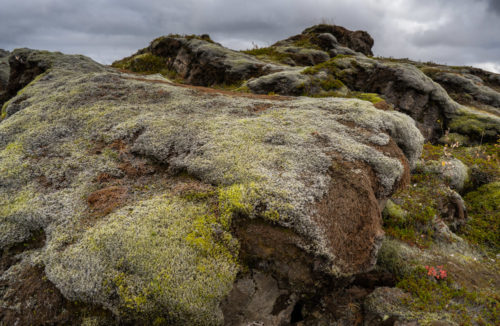
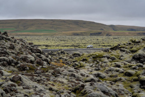
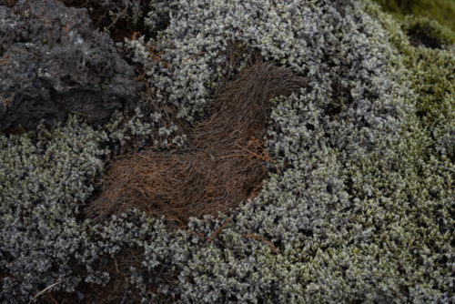
Moss is a common plant in Iceland. It grows abundantly in the mountainous region and is a special characteristic of Iceland’s lava fields. One of the most spectacular moss blankets is located on the southern coast of Iceland, over the Eldraun Lava Field. This is a good stop to take a closer look. About 10 min walk of lava rocks.
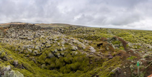
The Eldraun Lava Field was created in one of the most devastating eruptions in recorded history. Over a course of eight months, between 1783 and 1784, the Laki fissure and the adjoining Grímsvötn volcano poured out an estimated 14 cubic kilometres of basalt lava and clouds of poisonous gases that contaminated the soil, killing half of Iceland’s cattle and horses, and more than three-quarter of sheep. That year, nothing grew on the fields and no more fish could be found in the sea. The resulting famine killed approximately a quarter of Iceland’s human population.
But Laki’s eruption had even more widespread effects. In the years following the eruption, the climate across the Northern Hemisphere deteriorated. In North America, the winter of 1784 became the longest and one of the coldest on record. A huge snowstorm hit the South, the Mississippi River froze at New Orleans and there were reports of ice floes in the Gulf of Mexico.
Haze from the eruption floated east as far away as India weakening monsoon circulations and leading to drought and crop failures. The famine that hit Egypt in 1784, as a result of the eruption, killed roughly one-sixth of its population. The worst consequences were felt in Europe. The summer of 1783 was the hottest on record and a rare high-pressure zone over Iceland caused the winds to blow to the south-east. The poisonous cloud drifted across Europe, and its inhalation killed tens of thousands. In Great Britain alone, it caused some 23,000 deaths.
In France, a series of crop failures and the resulting poverty and famine eventually triggered the French Revolution of 1789-1799. Today, the Eldraun Lava Field looks very peaceful and serene. The thick green moss has helped softened the rugged landscape, almost disguising Eldhraun’s violent past.
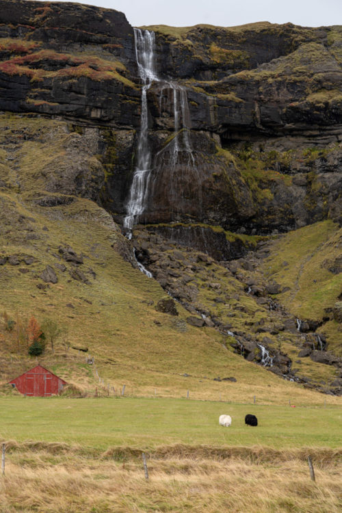
All along Ring road, you get several small waterfalls created out of the melting glacier. Here is one which I found interesting as there was a pair of sheep grazing one being White and another black at the foothill of this waterfall.

In fact, it was a twin waterfall as you can see in the panorama stitched using 26 slices which were captured vertically in three rows and then stitched in Lightroom to create this wide panorama.
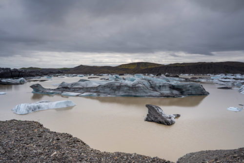
Fjallsárlón is a glacier lake at the south end of the Icelandic glacier Vatnajökull. Fjallsjökull which is part of the bigger glacier reaches down to the water of the lake and some icebergs are drifting by on its surface.
Fjallsárlón can be found off Iceland’s main Ring Road, 47 kilometres (29 miles) east of Skaftafell Nature Reserve. Reaching it is a bit tricky as a rough road from the Ring road 1 reaches the Fjallsárlón. We took this 4 Km detour to reach it despite not having a 4X4 vehicle. Since it was not snowing, we reached the glacier safely even though we were shaken and stirred a bit ?
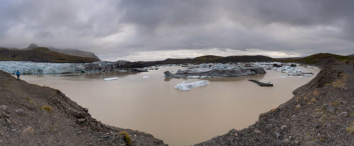
Fjallsárlón is a glacial lagoon in Iceland, located on the southern end of Vatnajökull glacier. The outlet glacier Fjallsjökull, originating from Vatnajökull, extends all the way to the lagoon’s surface, where large icebergs break away from the ice cap and fall into the water below.
With the many hundreds of icebergs that float atop the lagoon’s surface, Fjallsárlón is considered to be a strong second to the nearby, and more famous, Jökulsárlón glacial lagoon. Though smaller than its neighbour, it is less known, thus less crowded with other visitors.
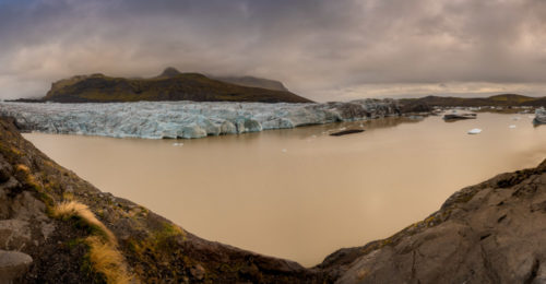
It is characterised by its unique and glittering icebergs. No iceberg is alike, with many hundreds of different shapes and sizes floating lazily atop the water. As these icebergs drift from place to place, they will often collide, exulting a loud groan as the ice rubs against itself.
For those visitors hoping to travel to Fjallsárlón during the summer months, it is important to be aware of the nesting Skuas, a large species of seabird known to protectively dive bomb anyone foolish enough to walk too close to their eggs.
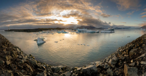
Our last destination that day was Jökulsárlón Glacier Lake. We reached it around 6 PM. Unfortunately, last boat tour was ending at 6 PM and we missed going close to these icebergs. Jökulsárlón, or ‘Glacier’s-River-Lagoon’ is one of Iceland’s most popular tourist spot. This lagoon is formed naturally from melted glacial water and is perpetually growing while big blocks of ice crumble from the ever-shrinking glacier.
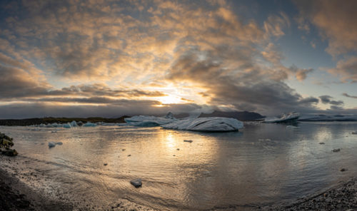
With a maximum depth of 248 metres, Jökulsárlón is Iceland’s deepest lake. The icebergs in Jökulsárlón are composed of ice that is over 1,000 years old. Jökulsárlón first started forming in 1934, when Breiðamerkurjökull glacier started retreating, leaving the lagoon in its path.
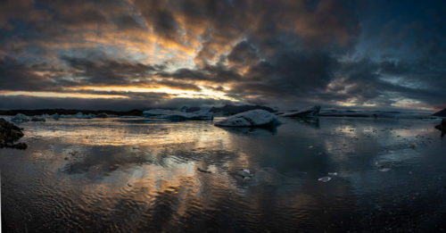
The lagoon connects with the ocean and is therefore composed of a sea and freshwater mixture which causes its unique colour. Seals can be seen in Jökulsárlón year-round, but they flock to the mouth of the lagoon to catch fish in the winter. Jökulsárlón sits south of Vatnajökull, Europe’s largest glacier.
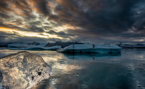
As Jökulsárlón increases in size, the retreating glacier visibly demonstrates the effects of global warming, with noticeable receding year after year. This, perhaps, makes the lagoon and the nearby glacier tongue even more special, as they will look different each time you pay them a visit.
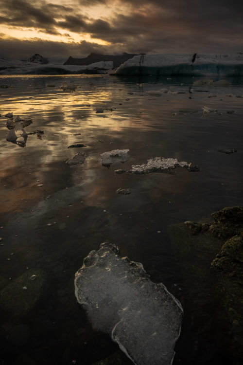
The icebergs that break away from the glacier and fall into the lagoon, slowly melt and drift out to sea, where they are polished by the North Atlantic waves before being washed ashore on the jet-black beach called Breiðamerkursandur.
This black stretch of sand is, therefore, always covered in translucent, compact ice sculptures that glisten in the sun, much like diamonds. This is why Breiðamerkursandur is nicknamed Diamond Beach.
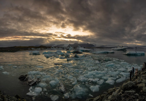
We spend time till sunset which unfortunately was not great due to the very dense cloud cover. Then we proceeded to the town of Höfn for our hostel stay at Höfn Hi Hostel. This lively fishing town and commercial centre of Höfn is a great base for travellers exploring Vatnajökull National Park and other wonders of Southeast Iceland.
I will cover the details of the 4th day in my next blog.
You can check earlier part of this series here.
Around Iceland in 8 days – Part 1
Around Iceland in 8 days – Part 2

Marvelously composed pictures !